
By Brooke Fisher
An increase in wildfires across the nation, especially along the West Coast, has lit a fire under many UW engineering researchers. And they’re responding in a number of ways — from developing cutting-edge safety technology to uncovering the long-term hazards of post-wildfire sediment transport.
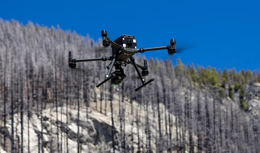
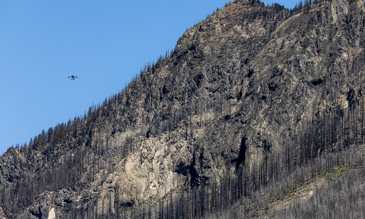
A drone gathers data along the Eagle Rock hilltop, devastated by the Bolt Creek fire. Photo credit: Dennis Wise / University of Washington
Improved escape route planning
During wildfire season, while working to contain and extinguish fires in rugged wilderness areas, firefighters are often in precarious situations — especially when the direction a wildfire is traveling suddenly shifts. To provide escape route suggestions, a team of aeronautics and astronautics (A&A) researchers is developing real-time drone-based technology.
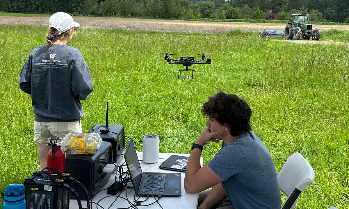
The researchers test their prototype last spring at a farm in Carnation, Washington. Photo courtesy of A&A researchers
“The idea is that as the drone is flying around, it can map out where the fire is,” says A&A Assistant Professor Karen Leung. “This can be used for decision support, to help those behind the line managing the operation. Safety is critical, so they can’t make a mistake.”
Currently, helicopters are used to monitor wildfires, but drones equipped with sensors could present a more efficient, cost-effective option. They can provide real-time data faster and have fewer restrictions on flying and launching. The project builds on Leung’s expertise enabling autonomous systems to operate safely around humans — from delivery robots that navigate sidewalks to driverless cars that share the road with motorists.
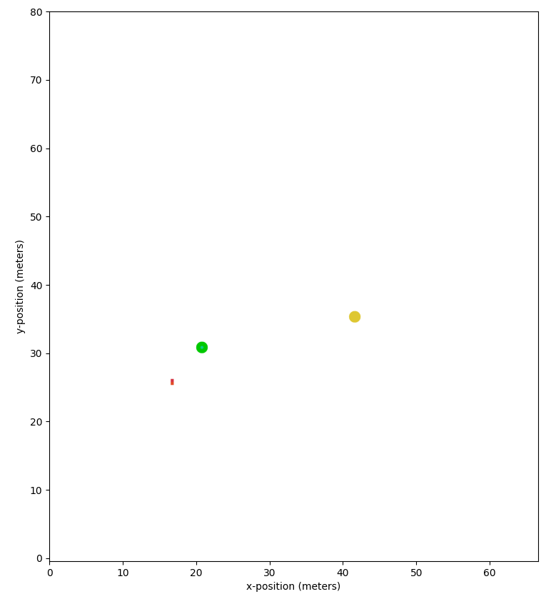
Based on a hypothetical situation, a fire map is created in real-time with thermal data gathered by a drone. The green dot indicates the location of firefighters and the gold dot denotes a cooler, safer area. The green line shows the optimal travel path. Video courtesy of A&A researchers
“This can also extend to drone applications, where the autonomy provides support for the human, but the human is ultimately making the final decision,” Leung explains.
The researchers are designing an integrative system that features a fire map produced in real-time with thermal data gathered by drone, with terrain and elevation maps overlaid to indicate steep cliffs or rivers. They’re also developing a path planning system that will recommend safe travel routes. Since wildfires can move quickly and unexpectedly change direction, the team will incorporate these variables into determining optimal escape routes.
To test their prototype, the team conducts test flights at a farm in Carnation, Washington. One enhancement they are working to implement entails improving the usefulness of the fire map by making the drone’s flight path more intentional.
“We want the drone to predict where there is greatest uncertainty in how the fire may propagate and spend more time mapping those areas — this could provide better maps and thus reduce risk and ambiguity for the crews on the ground,” explains research scientist Isaac Remy (BSEE ’23).
Understanding post-wildfire sediment hazards
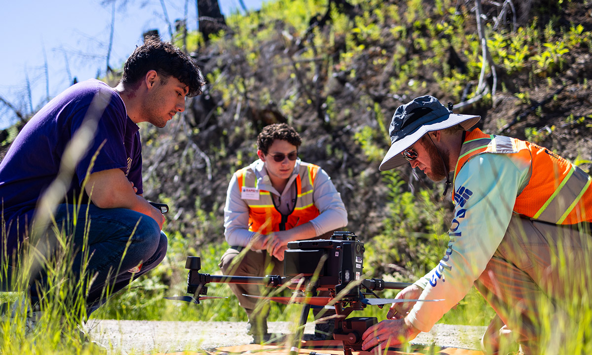
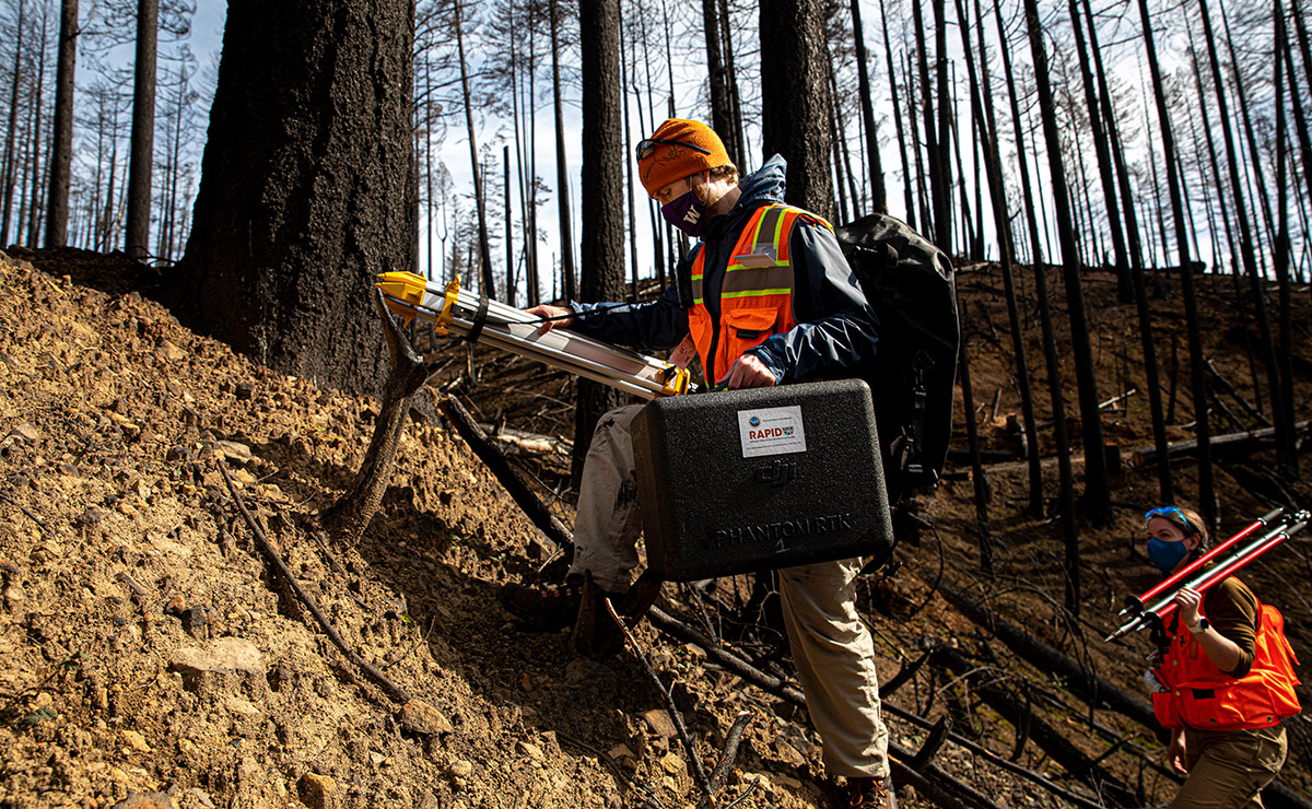
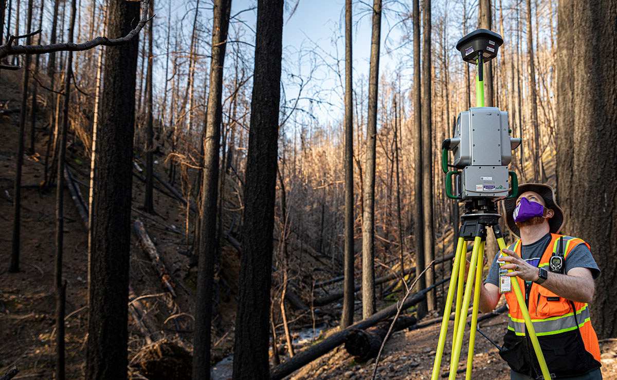
CEE Ph.D. student Hunter Jimenez, NHERI Summer Research Assistant Edan Miller and RAPID Center Staff Andrew Lyda, from left, prepare to launch a drone. Photo credit: Dennis Wise / University of Washington
A drone near the “Eagle Rock” hilltop, devastated by the Bolt Creek fire. Photo credit: Dennis Wise / University of Washington
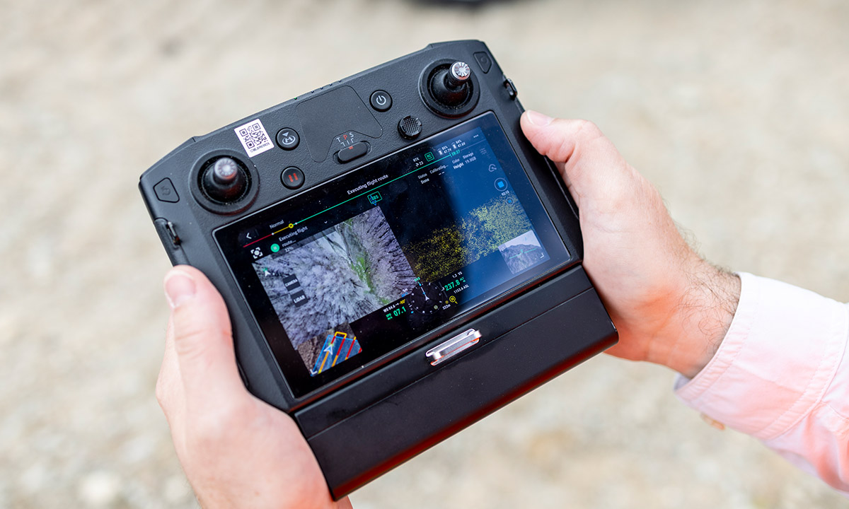
Real-time data on the drone flight controller shows aerial imagery on the left and lidar collection on the right. Photo credit: Dennis Wise / University of Washington
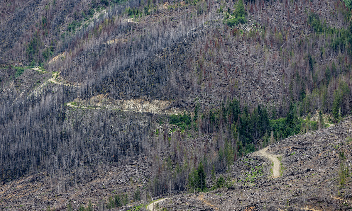
A road runs through an area affected by the Bolt Creek fire. Photo credit: Dennis Wise / University of Washington
Although home to scorched trees and barren soil, the upper slopes of the North Cascades, which were ravaged by the Bolt Creek fire in 2022, are fertile ground for research. To improve predictive models for hazards that occur several years following a wildfire — particularly risks associated with sediment traveling down the mountainside — a team of civil and environmental engineering researchers is gathering data.
“It’s inevitable that there is increased sediment yield, but when? If we know when, then we can prepare for it,” says Erkan Istanbulluoglu, professor of civil and environmental engineering.
The Bolt Creek fire burned more than 14,600 acres along a stretch of Highway 2 near Skykomish, Washington. The steep slopes above the Skykomish and Beckler rivers make it an ideal site to investigate the mechanics behind sediment transport, and the role it plays in flooding.
“Flooding is not only a rainfall problem, but a sediment problem. Typically, when assessing flood hazards, sediment isn’t considered as a factor,” explains Istanbulluoglu. “If we have megafires, a huge amount of sediment in the streams could cause a lot of flooding.”
Since most early warning models for post-fire debris flow were developed using data from drier climates, the researchers aim to improve models for areas with higher precipitation.
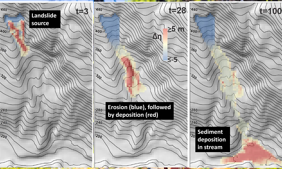
To model landslide risks following wildfires, the researchers will use a newly developed Landlab algorithm, shown above with data from a different watershed. From left: the unstable landslide is detected, the route the sediment will travel is identified, and the location where sediment enters the stream is pinpointed. Graphic courtesy of CEE researchers
In severe burn situations, soil may not fully recover the ability to absorb water for several months to a year, due to the formation of an organic water-repellent coating. This, together with decaying tree roots that no longer have the strength to hold soil in place, can cause increased sediment transport on steep slopes. While the risk typically peaks within several years, the precise timing is still unknown.
To survey the hilltops surrounding the Bolt Creek fire, the researchers collaborated with the Natural Hazards Reconnaissance Facility, known as RAPID. Data collected from drone-based lidar and aerial imagery will be used to build high-resolution elevation and terrain models, which will be compared to historical models to observe changes in topography. Using modeling software called Landlab, developed by Istanbulluoglu’s research group, real-life scenarios will also be simulated.
“Landlab takes in a variety of geophysical and hydrological data — it’s a merger between the two,” explains Ph.D. student Hunter Jimenez. “It considers root cohesion and also the effects of soil saturation. Looking at both heralds a new development in landslide research.”
Advancing wildfire research
Researchers from the RAPID Center hike into Bogus Creek in Oregon, devastated by the Umpqua National Forest fire. Photo credit: Mark Stone / University of Washington
Since the RAPID Center launched six years ago, post-wildfire deployments have not only surfaced, but have spread quickly — not unlike wildfire.
Related story
A burning need
Learn more about how the CEE RAPID Center gathered perishable data following the 2020 megafires.
“When we started the facility, wildfire was not mentioned a single time in the [funding] proposal and now it’s about 30% of what we do,” says RAPID Director Joe Wartman, a professor in civil and environmental engineering.
This new class of extreme events, which includes wildfires and also landslides, is triggered by warming temperatures, says Wartman. In response, the facility — which is based at the UW — has incorporated them into its mission to respond to natural disasters such as hurricanes, earthquakes, tsunamis and more. The first center of its kind in the world, RAPID has transformed the natural hazards reconnaissance field by offering mission planning and deployment support for extreme event reconnaissance organizations, universities, government agencies and international organizations.
To meet the demand for post-wildfire resources, the center continues to advance its offerings, from growing its collection of more than 100 unique state-of-the-art pieces of equipment to enhancing data processing and archiving protocols to ensure that data sets may be reused and shared.
“Understanding the cascading effects are a big part of wildfire research,” explains Wartman. “Things like ash can enter the groundwater system and permanently destroy water resources. In rural areas, the water can become fully contaminated and people can no longer use the wells.”
Originally published September 2, 2024